Fast Moving Storm Line Puts Nearby Areas on Alert
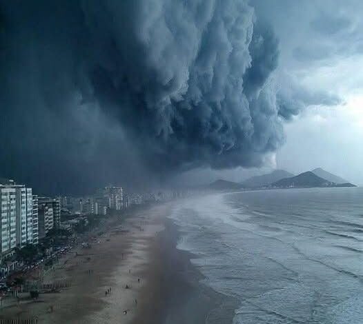
A fast-moving line of severe thunderstorms can change an ordinary afternoon within minutes. Skies darken, wind increases, and heavy rain reduces visibility before many people have finished checking the forecast. When meteorologists warn that a storm line is approaching nearby cities, the most important advantage residents have is the time remaining before it arrives.
Storm lines can produce damaging straight-line winds that are sometimes mistaken for tornadoes. Those winds may bring down trees, power lines, signs, and weak structures across a broad area. Outdoor furniture, trash containers, and construction materials can become airborne. Securing loose objects early prevents a last-minute trip outside when conditions are already dangerous.
Lightning is another immediate threat. Thunder means lightning is close enough to cause harm, even if rain has not started. People at parks, sports fields, pools, and worksites should move into a substantial building or enclosed vehicle. Shelters with open sides do not provide the same protection, and standing beneath an isolated tree increases risk.
Heavy rainfall can overwhelm drains and create flash flooding. Water may rise quickly on roads, particularly under bridges and in low areas. Drivers should never assume a flooded section is shallow or stable. Flowing water can hide damaged pavement and move a vehicle with surprising force. Turning around is safer than gambling on a route that appears familiar.
Families should charge phones and portable battery packs while power remains available. Flashlights are safer than candles during an outage. Medication, drinking water, pet supplies, and important contact numbers should be easy to reach. These preparations are useful even when the storm weakens because strong weather can still interrupt electricity and travel.
The safest room depends on the hazard. For destructive wind or a tornado warning, people should move to a small interior room on the lowest practical floor, away from windows. Mobile homes and temporary structures offer limited protection and should be left well before the storm arrives if a sturdier shelter is available.
Warnings should come from reliable local weather services and emergency authorities. Social-media posts can spread quickly, but old radar images and warnings from another region are often reshared without context. Checking the location, issue time, expiration time, and named communities prevents confusion. Wireless emergency alerts should remain enabled on mobile phones.
Businesses and schools need a plan that does not depend on improvisation. Staff should know who makes the decision to shelter, where people should go, and how attendance will be checked. Waiting until windows shake or power fails wastes the small preparation window that an official alert is meant to provide.
After the line passes, danger may remain. Downed wires can be hidden by branches or water and should always be treated as live. Damaged trees may continue falling, and flooded roads can worsen as runoff moves downstream. Residents should wait for official guidance before leaving shelter and report hazards without approaching them.
Severe weather alerts are not predictions that every house will be damaged. They are notices that the atmosphere can produce dangerous conditions somewhere in the warned area. Preparing does not require panic. It requires a few deliberate actions taken early: go indoors, secure loose objects, charge essential devices, identify the safest room, and keep verified information close until the storm line has moved away.
Neighbors can help one another without putting themselves at risk. A quick message to an older resident, a family without transportation, or someone who may not receive mobile alerts can provide the warning they need. Plans should include pets, mobility equipment, and medical devices that require electricity. Preparation works best when it accounts for the people and animals who cannot simply move to shelter without assistance.